COMPUTE
This command contains modules that compute various attributes and functions based on one or more mesh objects. This operation will (often) result in new attributes being added to the mesh objects. The action of the command will be controled by the keyword in the second argument position.
SYNTAX
compute/distance_field/mo_sink/mo_source/distance_field_attribute

compute/signed_distance_field/mo_sink/mo_source/distance_field_attribute

compute/linear_transform/mo_main/mo_surface/[direction/att_name]
distance_field is the keyword for distance field calculation. Determine
the minimum distance from any node in
mo_source to every node in mo_sink and place the result in the
node based floating point attribute,
distance_field_attribute in mo_sink. The computation is
accelerated by using the kdtree search algorithm.
signed_distance_field is the keyword for signed distance field
calculation. Determine the minimum distance
from any node in mo_source to every node in mo_sink and place the
result in the node based floating
point attribute, distance_field_attribute in mo_sink. The
computation is accelerated by using the
kdtree search algorithm.
This option requires the mo_source MUST be either a triangle or quad surface mesh object. If the surfaces form a topologically closed volume then
positive, ‘above’ distance is in the direction of the surface normal vector. Negative is ‘below’ the
surface. If the surface is not a closed volume, then the assumptions described in the
surface command are used to determine what is above and what is below the surface.
linear_transform is the keyword for an extrapolation from an attribute
value in a surface onto every node of a 3D mesh.
Given a 3D mesh and a 2D surface, this command will extrapolate a scalar value from that surface onto every point of the mesh. This can be used to (for example):
- Propagate head values from a surface onto all nodes of a mesh.
- Expand a mesh to fit a surface, by propogating the appropriate spatial coordinate.
- Compute the depth relative to a topographic surface to each node of a mesh.
This is highly dependant on the spatial relation between the mesh
and the surface - values from the surface are extrapolated “downward” into the mesh in the direction
specified in the command. The
direction specified in the command must be one of
zpos, zneg, ypos, yneg, xpos, xneg
For example, specifing [zpos] will result in the upper (positive z-axis) side of the mesh having attribute values conforming exactly to those on the surface, while the lower side of the mesh will have whatever attribute values it had previous, with all nodes in between having attribute values distributed linearly between the two extremes. If a direction is not specified, it will default to zpos. If an attribute is not specified, it will default to the spatial attribute appropriate to the chosen direction (i.e. if the direction is yneg, the attribute will default to yic, the y-coordinate of each node. The attribute chosen must already exist in both the surface and main meshes.
Other places to look for modules that compute some standard mesh attributes include, QUALITY, which will compute aspect ratio and volume, cmo/addatt, which will compute normal vectors, dihedral angles, solid angles, meadian points, Voronoi points and more. User functions can be computed with MATH.
EXAMPLES
cmo / create / cmo_src
createpts/rtz/1,91,1/3.,0.,0./3.,270.,0./1,1,1/
cmo / create / cmo_snk
createpts / xyz / 30 30 1 / -5. -5. -5. / 5. 5. 5. / 1 1 1
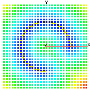
compute / distance_field / cmo_snk / cmo_src / dfield
finish